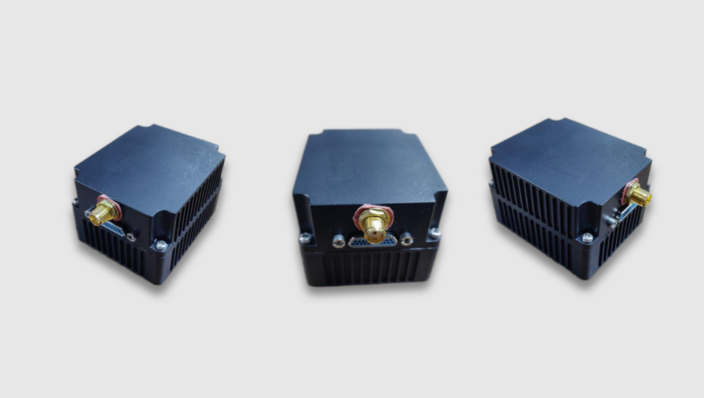
Overview
The integrated navigation system consists of gyroscope, accelerometer, GNSS antenna, GNSS receiver and navigation computer. The system can complete the initial alignment under static/dynamic base condition, receive real-time navigation information of satellite receiver and inertial measurement information for integrated navigation solution, and output measurement information such as angular velocity, overload, speed, position and attitude of the carrier. The main functions of the inertial navigation system are as follows:
- With self-test function;
- Support external bookbinding ephemeris;
- With software online upgrade function;
- With test parameter writing function;
- With software version reporting function;
- With static/dynamic base transfer alignment function;
- Have the corresponding measures against aliasing;
- Output GNSS receiver position, speed information;
- Output attitude Angle, position and velocity information after integrated navigation data fusion;
- Output angular velocity and acceleration (overload) information in the inertial measurement unit;
- According to the satellite signal quality, automatically select the function of working in the combined state or pure inertia state;
Performance index
Power supply
- Peak current:≤0.5A;
- Working current:≤0.35A;
- Input voltage: 28V DC (with isolation)
Inertial Measurement Unit
- Angular velocity measurement range:-500°/s~+500°/s
- Acceleration measurement range:-30g~+30g
Satellite receiver unit
- Cold start time:not greater than40s;
- Hot start time:not greater than10s;
- Guide system:BDS(compatible with GPS);
- Lost lock recapture time:not more than 2s(lost lock within 5s);
- Frequency:B3(1268.52±20MHz)(compatible GPS L1(1575.42MHz±2.046MHz);
Navigation solution accuracy
Attitude Angle range
- Yaw Angle:-180°~+180°;
- Pitch Angle:-90°~+90°;
- Roll Angle:-180°~+180°;
Static/dynamic base
- Static/dynamic base attitude Angle alignment accuracy:≤0.2°(3σ);
- Static/dynamic base speed alignment accuracy:≤0.1m/s(1σ)。
Position accuracy
- After navigation begins:position accuracyΔR≤15m(3σ, GNSS signal);
- Within 60 seconds after navigation starts:position accuracyΔR≤40m(3σ,no GNSS signal);
- Within 80 seconds after navigation starts::position accuracyΔR≤70m(3σ,no GNSS signal);
- Within 120 seconds after navigation starts::position accuracyΔR≤100m(3σ,no GNSS signal);
Attitude Angle accuracy
- Tilt、roll:≤0.6°(3σ, GNSS signal,Alignment error included);
- Tilt、roll:≤0.6°(3σ,no GNSS signal,Navigation time≥60s,
- Alignment error included);
- Tilt、roll:≤0.8°(3σ,no GNSS signal,Navigation time≥80s,
- Alignment error included);
- Tilt、roll:≤1°(3σ,no GNSS signal,Navigation time≥120s,
- Alignment error included);
- Yaw:≤0.6°(3σ,GNSS signal,Navigation time≥60s);
- Yaw:≤0.8°(3σ,GNSS signal,Navigation time≥80s);
- Yaw:≤1°(3σ,GNSS signal,Navigation time≥120s);
Velocity accuracy
- GNSS signal:≤0.3m/s(1σ);
- No GNSS signal:
- ≤2m/s(1σ,Navigation time≥60s);
- ≤3m/s(1σ,Navigation time≥80s);
- ≤4m/s(1σ,Navigation time≥120s);
External Ports
Attitude Angle range
- Weight:about 170g;
- External connector:J30J-21TJP;
- Baud rate:460800 bps;
- Size:60 mm×50 mm×40mm;
- Communication interface:Three RS422communication interfaces;
- Output update rate:IMU measurement data is500Hz,navigation data is 250Hz,and navigation data is10Hz;
